

Media Release for SIWI World Water Week (28 Aug – 2 Sep)
Drilling for water is a fraught business in Africa – like being a pirate without a treasure map. In many areas, the rock is old – some of the oldest on our planet. This cracked, shattered stone that is blasted by desert heat or soaked in tropical rains with often only a thin covering of rust-stained soil, can hold substantial amounts of water, but a driller needs to know where to look and the skill to develop a water source that will last. A metre or two can make the difference between a dry hole and a well that could supply a village or a farm for a lifetime.
The good news is that in many parts of Africa, there is more groundwater available close to most areas where it is needed and the potential to store more with land use or technology changes. Currently, groundwater is an underused natural resource in much of Africa – where water insecurity is rife and drought is currently threatening the lives and livelihoods of millions of people in southern and eastern Africa. For once, there may even be a rare silver lining to climate change – as it appears that in some environments groundwater recharge happens more readily when rainfall intensity is high[1]. Thus understanding and managing Africa’s aquifers should be central to poverty alleviation and climate resilience strategies.
A challenge up until now has been the lack of easily available groundwater information:
“When you drill a borehole in the UK, there are incredibly detailed maps and borehole logs [registered with the British Geological Survey (BGS)] to help you decide where to drill,” said Sean Furey, a water and sanitation specialist at Skat told The Guardian[2]. “Even in countries where a similar organisation exists, that sort of data isn’t available because NGOs, the private sector or even governments who commission boreholes aren’t aware that they need to submit their drilling logs.”
In May, the Africa Groundwater Atlas was launched and is a major step forward in addressing this information gap.
The British Geological Survey has developed the Atlas in partnership with the International Association of Hydrogeologists (IAH) Burdon Groundwater Network for Developing Countries, and with more than 50 collaborating groundwater experts across Africa.
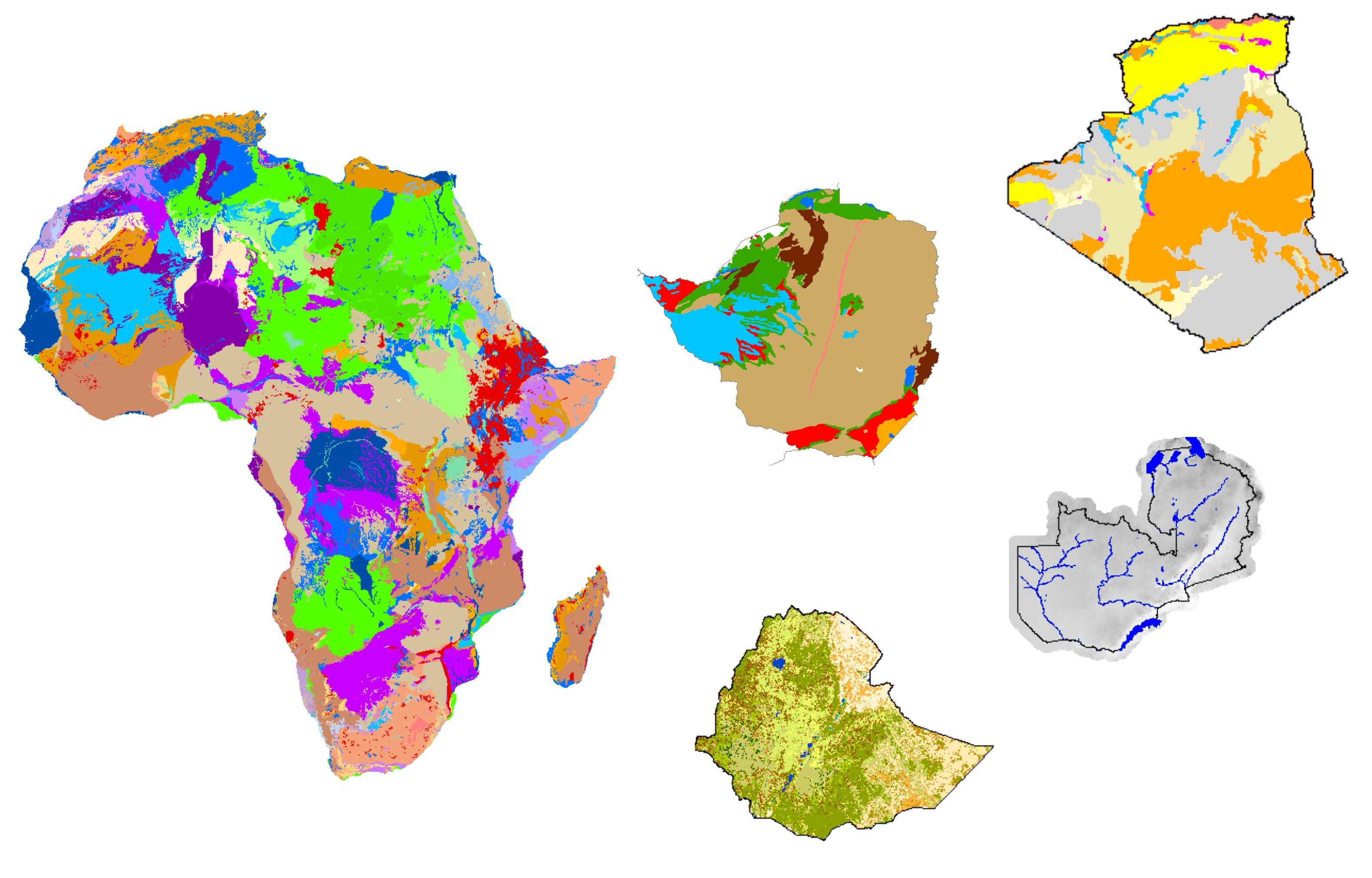
For each of 51 African countries, the Africa Groundwater Atlas provides new overview geology and hydrogeology maps and summaries of the key geological environments and aquifers in each country. There are sections on groundwater status, use and management, including groundwater monitoring, with up to date information on the national organisations involved in groundwater development and management. There is supporting material on geographical setting, climate, surface water, soil and land cover, with accompanying maps; and finally, there are references and links to more detailed information for those wishing to find out more.
Accompanying pages highlight important issues related to African groundwater, such as recharge, groundwater development techniques and transboundary aquifers; with links to sources of further information.
Also available is the Africa Groundwater Literature Archive, which enables users to search (geographically and by keyword) and freely access thousands of articles, reports and other documents about African groundwater.
The Africa Groundwater Atlas is still being developed. Some of the pages still have limited information, and for many others there may be more details to be added or updates to be made – and there is still a need for country-level collection of borehole logs. However, if you are working in Africa on rural or urban water supply, water resources, environmental protection, agriculture, mining or forestry, you should bookmark the Atlas in your web browser today.
We can’t tell you if X marks the spot of the hidden treasure you are looking for – but at least now you have a map.
Figure 1: Africa Groundwater Atlas overview[3]
More information
The Africa Groundwater Atlas was developed as part of the UPGro programme– Unlocking the Potential of Groundwater for the Poor (https://upgro.org). UPGro is funded by UK Aid; the UK Natural Environment Research Council (NERC); and the UK Economic and Social Research Council (ESRC). Knowledge Broker: Skat Foundation, in partnership with the Rural Water Supply Network (RWSN) www.rural-water-supply.net
The Africa Groundwater Atlas and Literature Archive are at http://www.bgs.ac.uk/africagroundwateratlas/index.cfm
http://earthwise.bgs.ac.uk/index.php/Africa_Groundwater_Atlas_Home
For more information and to get involved, please contact Brighid Ó Dochartaigh at [email protected]


